File list
Jump to navigation
Jump to search
This special page shows all uploaded files.


| Date | Name | Thumbnail | Size | User | Description | Versions |
|---|---|---|---|---|---|---|
| 04:08, 9 March 2019 | NZMS13 map.jpg (file) |  |
889 KB | Wiki-PeteKing | 1 | |
| 03:28, 3 March 2019 | Korufruit square.png (file) |  |
53 KB | Wiki-PeteKing | 1 | |
| 03:27, 3 March 2019 | Korufruit.png (file) |  |
189 KB | Wiki-PeteKing | 2 | |
| 08:11, 1 March 2019 | Umn logo.png (file) |  |
19 KB | Wiki-Sdlime | 2 | |
| 07:42, 1 March 2019 | Azavea-logo.png (file) |  |
5 KB | Wiki-Sdlime | 1 | |
| 02:05, 1 March 2019 | Foss4g-sotm-2019-logo-comp-adamsteer-colour.png (file) |  |
523 KB | Wiki-Adamsteer | updated colouring | 2 |
| 01:59, 1 March 2019 | Foss4g-sotm-2019-logo-comp-adamsteer-bw.png (file) |  |
644 KB | Wiki-Adamsteer | 2 | |
| 01:08, 1 March 2019 | F4g-sotm-oceania-2019-logoproposal-ads-colourselection.png (file) |  |
760 KB | Wiki-Adamsteer | 1 | |
| 22:25, 28 February 2019 | Foss4g-oceania-logo-ads-hexcolour.png (file) |  |
157 KB | Wiki-Adamsteer | 1 | |
| 13:15, 25 February 2019 | Foss4g sotm oceania wgtn2019 2.jpg (file) |  |
700 KB | Wiki-Dwsilk | Logo variants for FOSS4G SotM Oceania 2019 by Tim Denee | 1 |
| 13:14, 25 February 2019 | Foss4g sotm oceania wgtn2019.jpg (file) |  |
277 KB | Wiki-Dwsilk | Logo submission for FOSS4G SotM Oceania 2019 by Tim Denee | 1 |
| 14:21, 20 February 2019 | Hobulogo.png (file) |  |
16 KB | Wiki-Sdlime | 1 | |
| 12:48, 20 February 2019 | Logo-extensis.png (file) |  |
23 KB | Wiki-Sdlime | 1 | |
| 22:59, 11 February 2019 | ProfilePhoto.jpg (file) |  |
33 KB | Rahulworld | 1 | |
| 10:44, 11 February 2019 | Bh-logo.jpg (file) |  |
17 KB | Wiki-Sdlime | 1 | |
| 10:39, 11 February 2019 | Celartem Logo.jpg (file) |  |
7 KB | Wiki-Sdlime | 1 | |
| 06:39, 11 February 2019 | Kilsedar.jpg (file) |  |
1.91 MB | Kilsedar | 3 | |
| 03:33, 6 February 2019 | Logo-qgis.png (file) |  |
78 KB | Wiki-MartinDobias | New QGIS logo (since QGIS 3.0) | 2 |
| 07:13, 28 January 2019 | GCI-2018-results.png (file) |  |
30 KB | Jmckenna | Results of OSGeo's participation in the 2018 Google Code-in contest. | 1 |
| 15:13, 21 January 2019 | Jonahsullivan.jpg (file) |  |
108 KB | Jonahsullivan | user avatar | 1 |
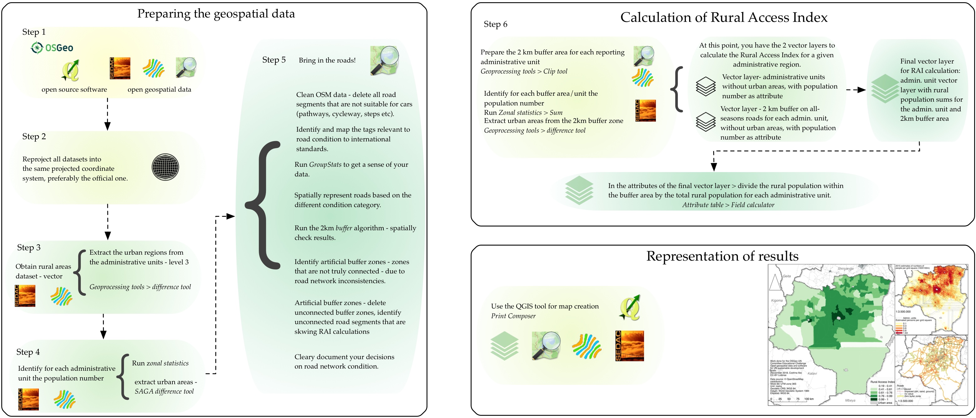
| 03:33, 21 January 2019 | Fig25 workflow.jpg (file) |  |
805 KB | Codrina | Conceptual schema for the workflow to calculate the Rural Access Index using open data and open source software. | 1 |
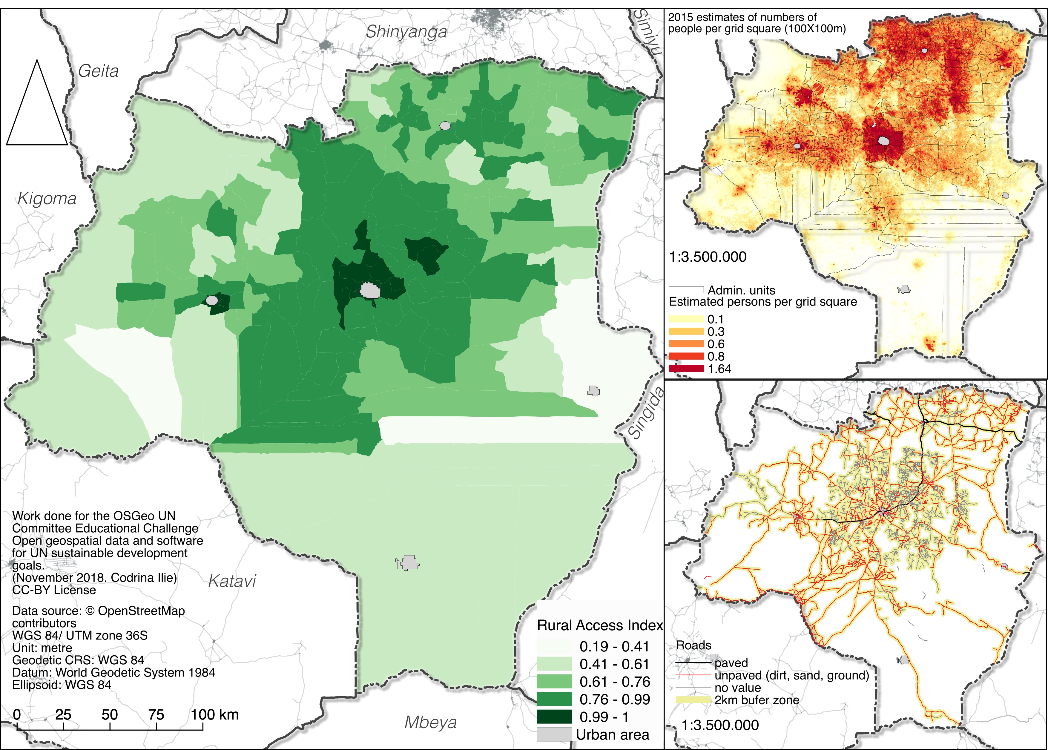
| 03:31, 21 January 2019 | Fig24 RAI.jpg (file) |  |
1.9 MB | Codrina | Rural Access Index calculated for Tabora county, Tanzania. | 1 |
| 03:28, 21 January 2019 | Fig23 segments-2000.jpg (file) |  |
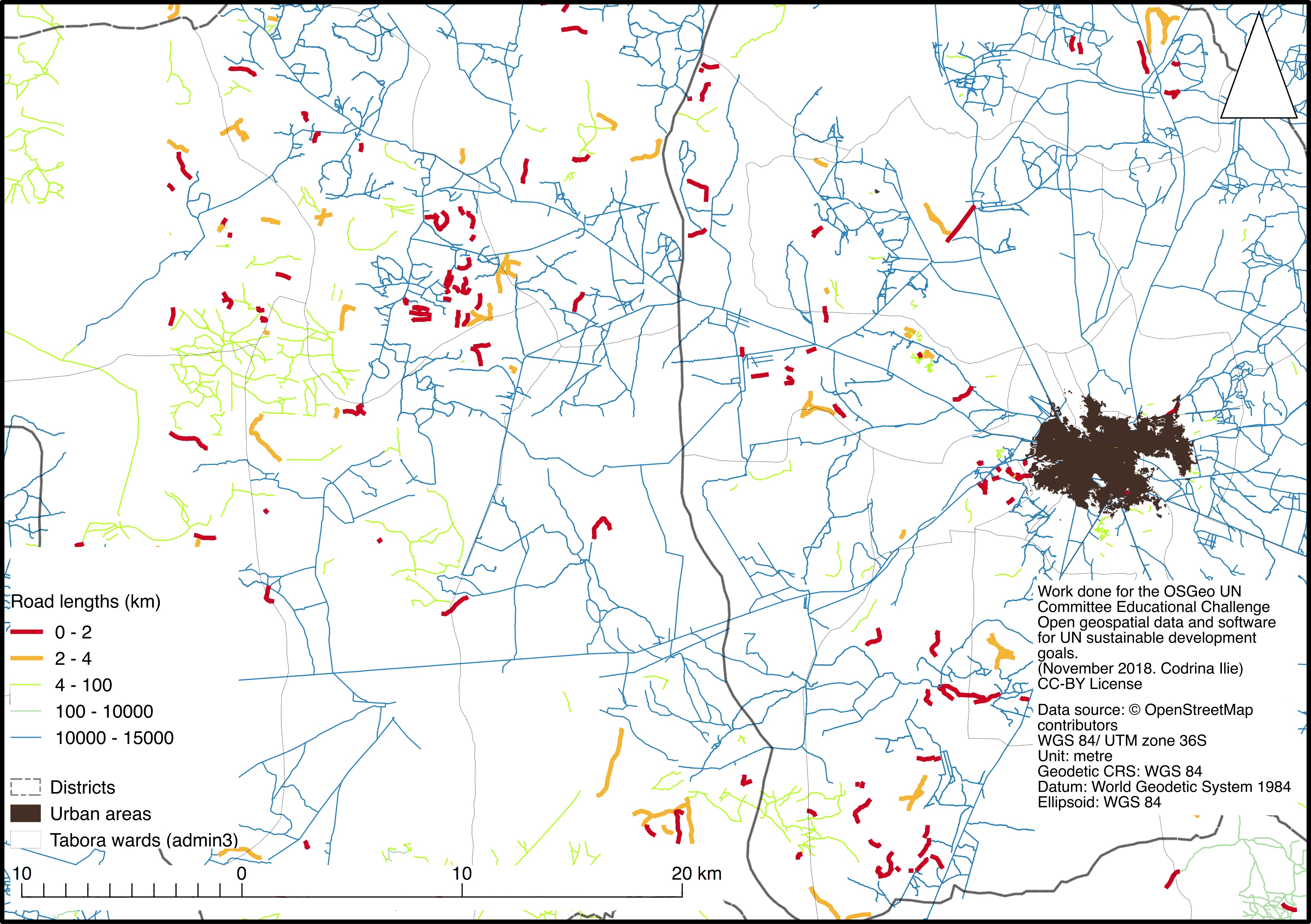
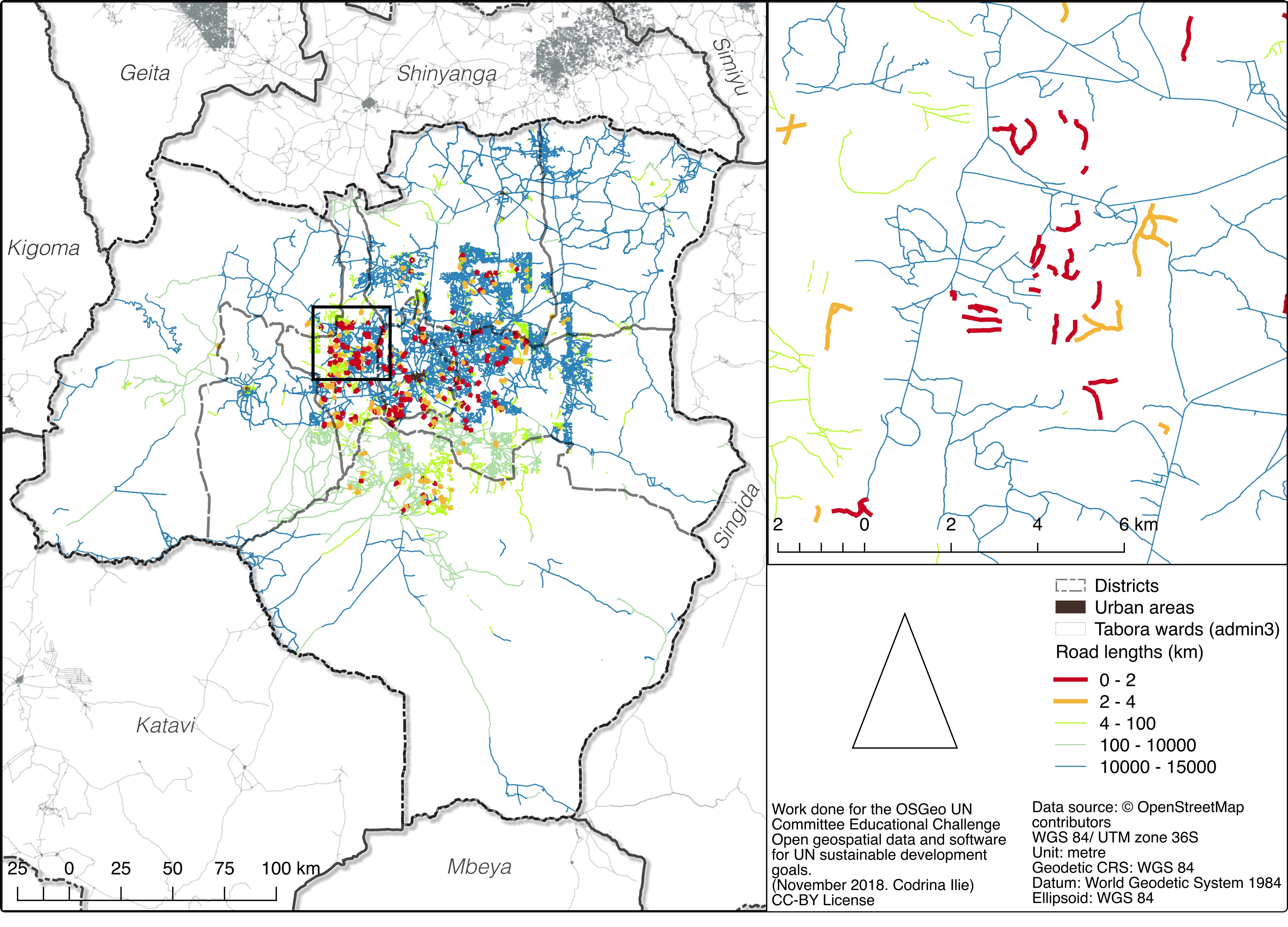
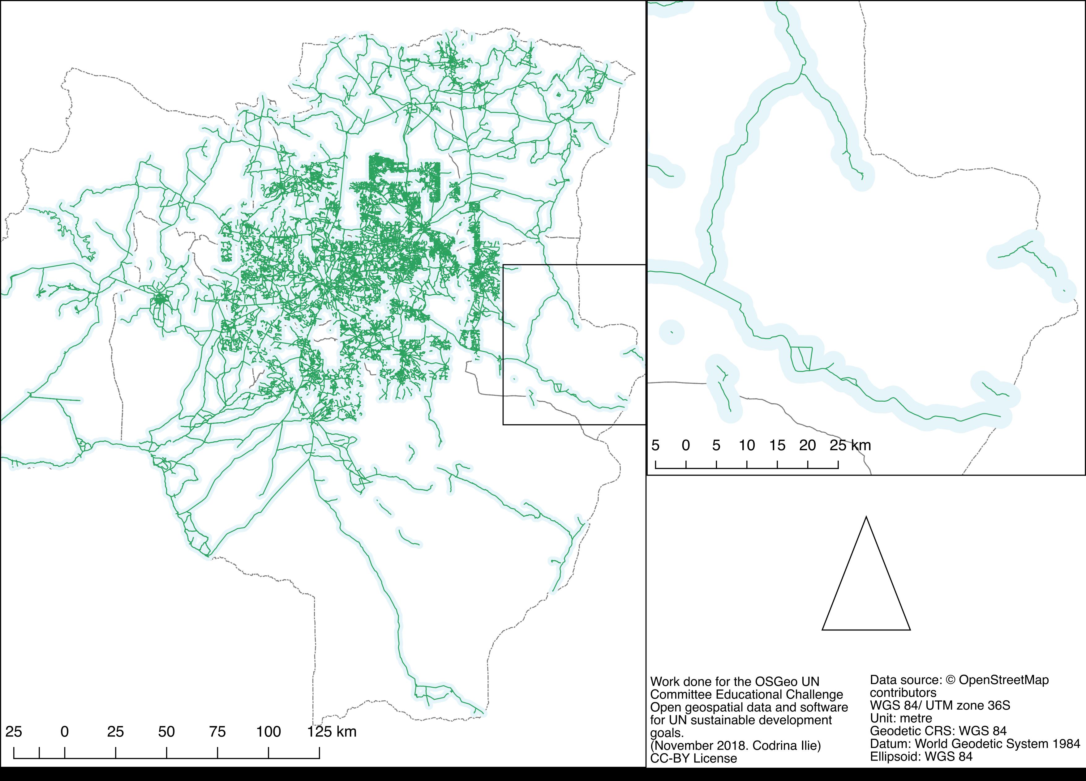
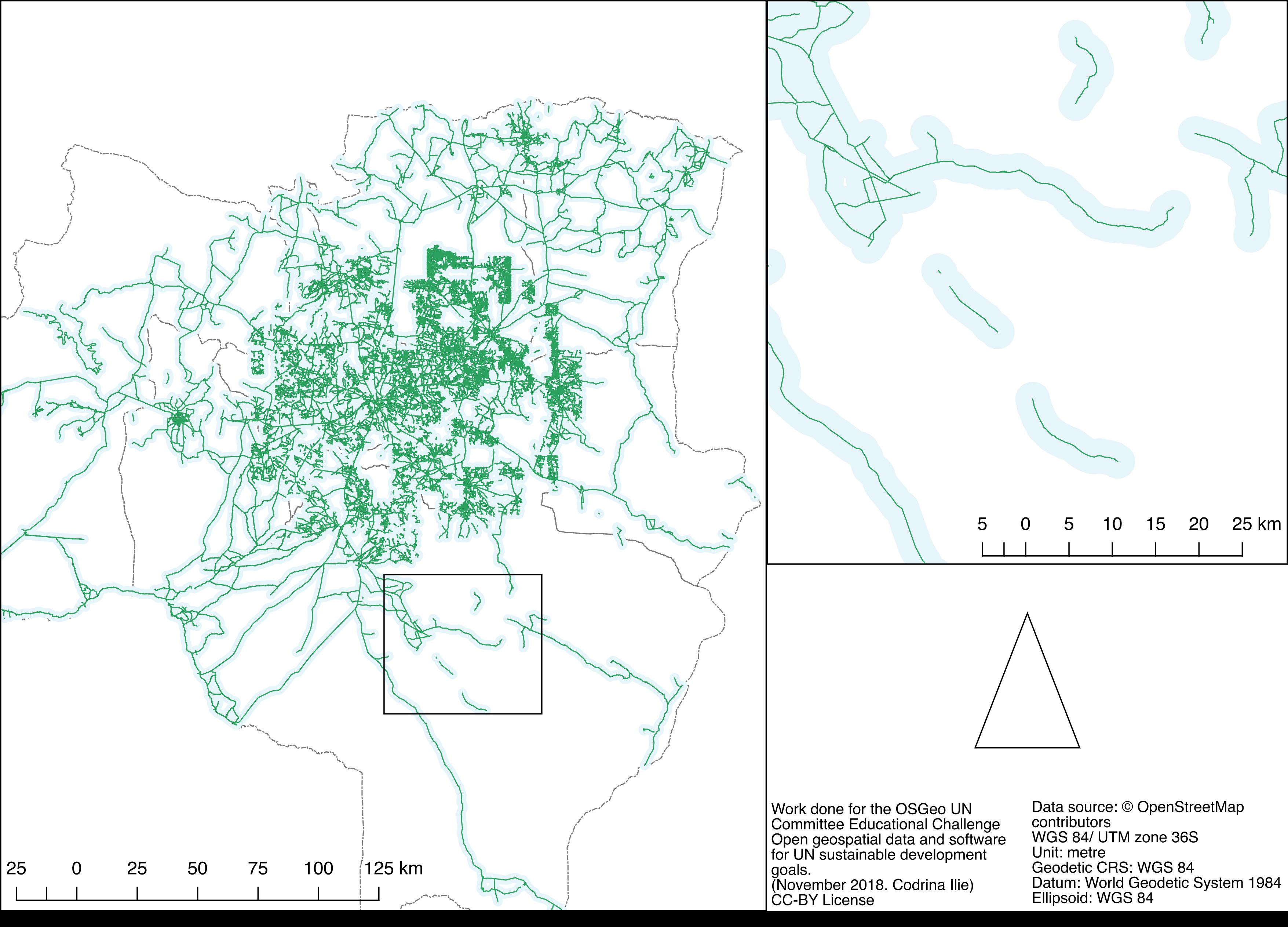
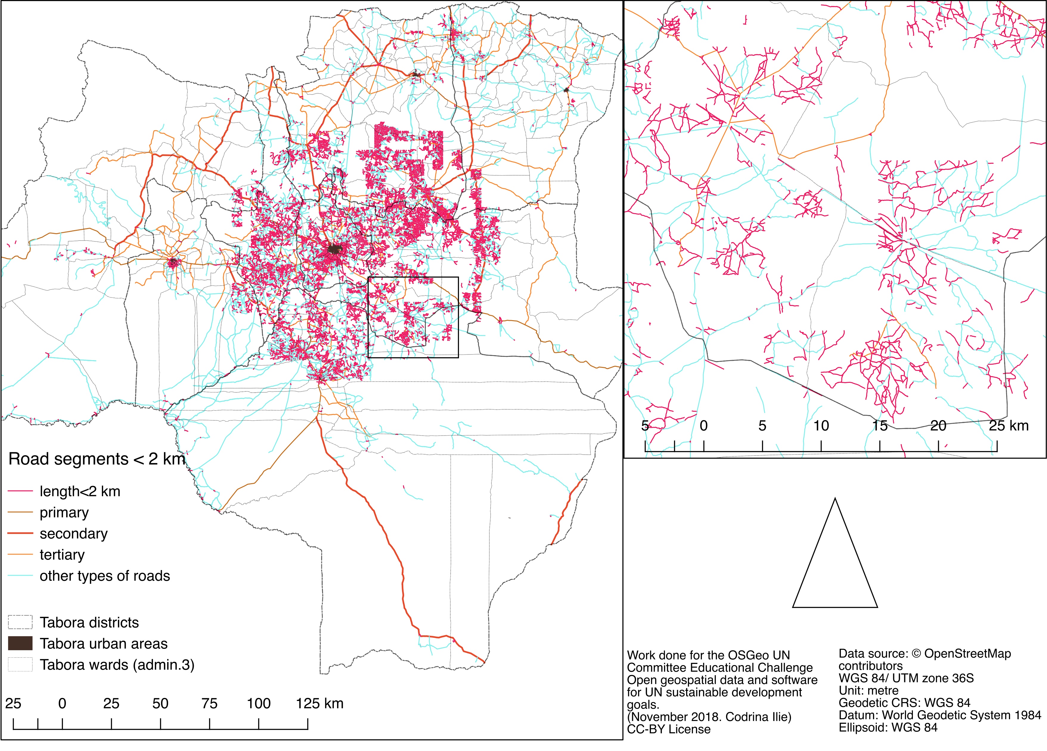
1.9 MB | Codrina | Spatial distribution of the shorter than 2 km road segments | 1 |
| 03:25, 21 January 2019 | Fig22 networks-2000.jpg (file) |  |
1.78 MB | Codrina | Spatial distribution of road segments of computed networks, by lengths (km) | 1 |
| 03:23, 21 January 2019 | Fig21 roads GRID results.jpg (file) |  |
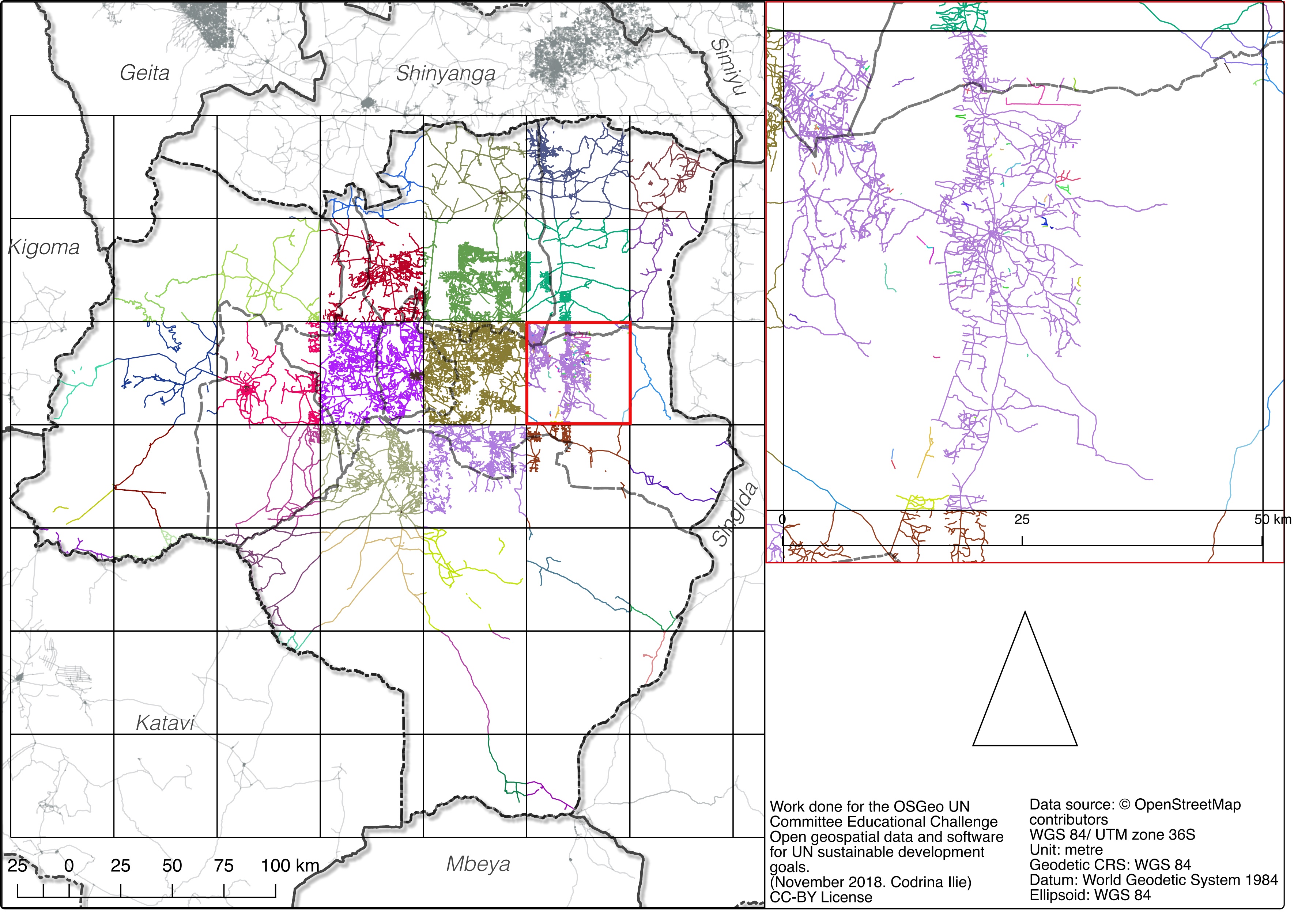
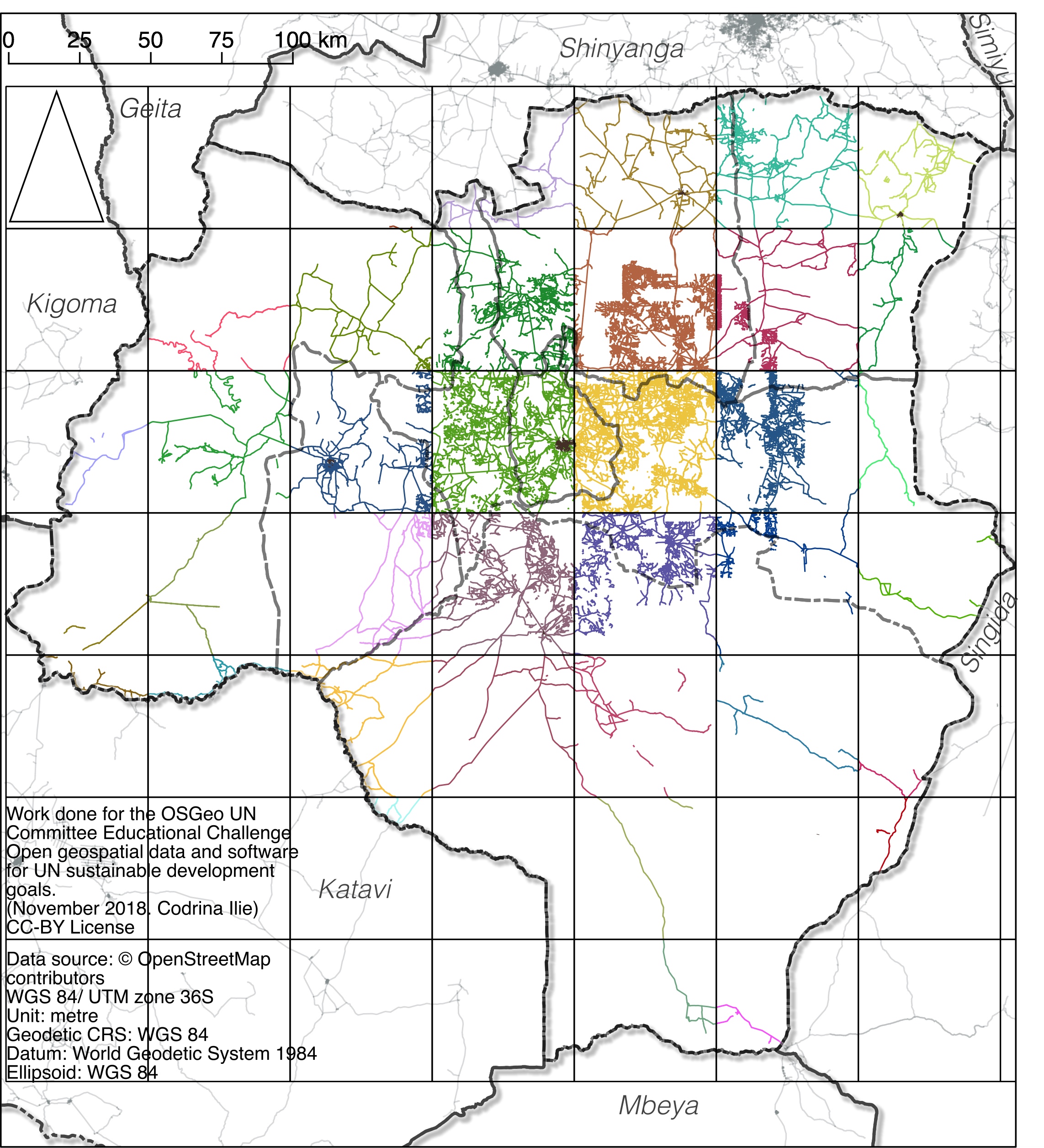
1.86 MB | Codrina | Result of the subnet creation script | 1 |
| 03:21, 21 January 2019 | Fig20 roads GRID.jpg (file) |  |
1.47 MB | Codrina | The 50X50KM grid and the corresponding road segments | 1 |
| 03:18, 21 January 2019 | Fig19 buffer-2km.jpg (file) |  |
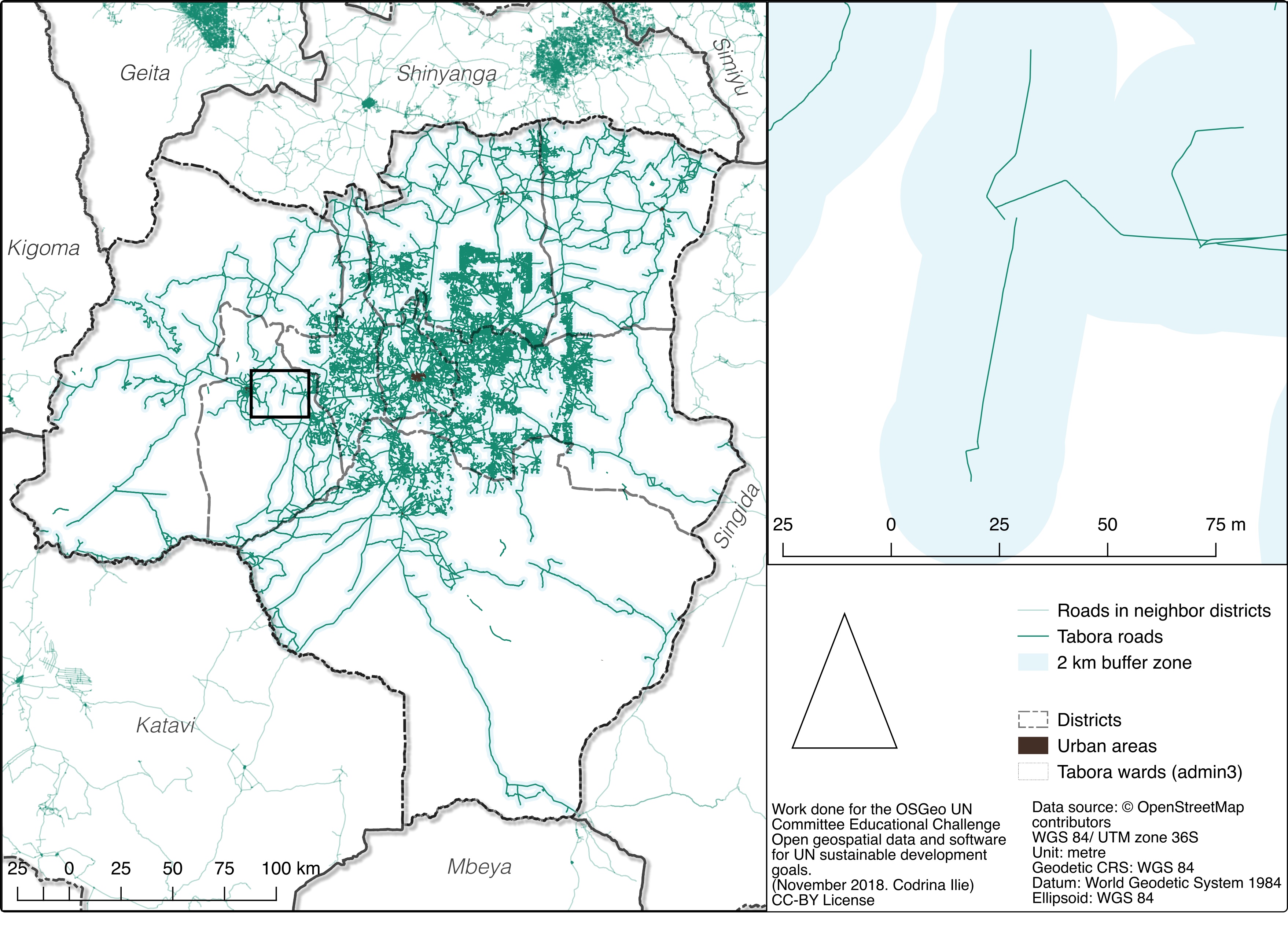
1.64 MB | Codrina | Unconnected road segment to be considered in the Tabora district RAI calculation | 1 |
| 03:16, 21 January 2019 | Fig18 buffer-2km.jpg (file) |  |
1.63 MB | Codrina | Exemplification of issues determined by the poor connectivity of road network | 1 |
| 03:09, 21 January 2019 | Fig17 buffer RAI.jpeg (file) |  |
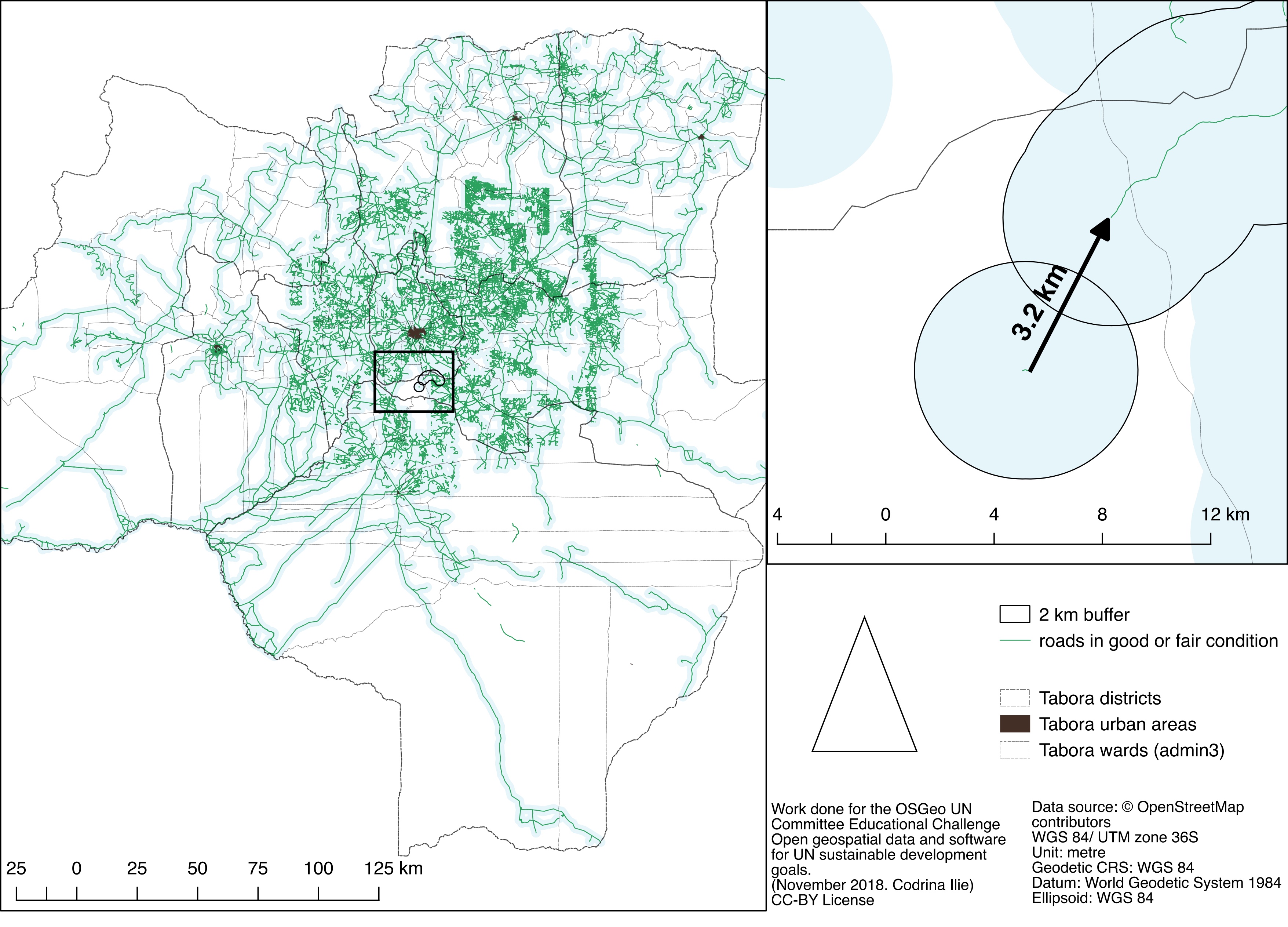
709 KB | Codrina | Example of unconnected road buffers that are intersecting the county border. | 1 |
| 03:07, 21 January 2019 | Fig16 buffer initial.jpeg (file) |  |
709 KB | Codrina | Spatial distribution of unconnected road buffers. | 1 |
| 03:04, 21 January 2019 | Fig15 length2000DiffStats.png (file) |  |
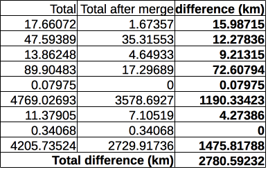
36 KB | Codrina | The difference between the total length of road segments shorter than 2 km before and after running MergeLines plugin - results of GroupStats. | 1 |
| 03:03, 21 January 2019 | Fig14 length2000.png (file) |  |
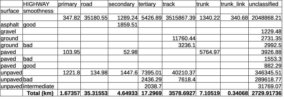
67 KB | Codrina | The total length of OSM road segments shorter than 2 km, by road, surface and smoothness type, after the merge operation - results of GroupStats | 1 |
| 03:00, 21 January 2019 | Fig13 length2000 initial.jpg (file) |  |
1.93 MB | Codrina | Spatial distribution of all OSM road segments shorter than 2km. | 1 |
| 02:58, 21 January 2019 | Fig12 length2000 initial Stats.png (file) |  |
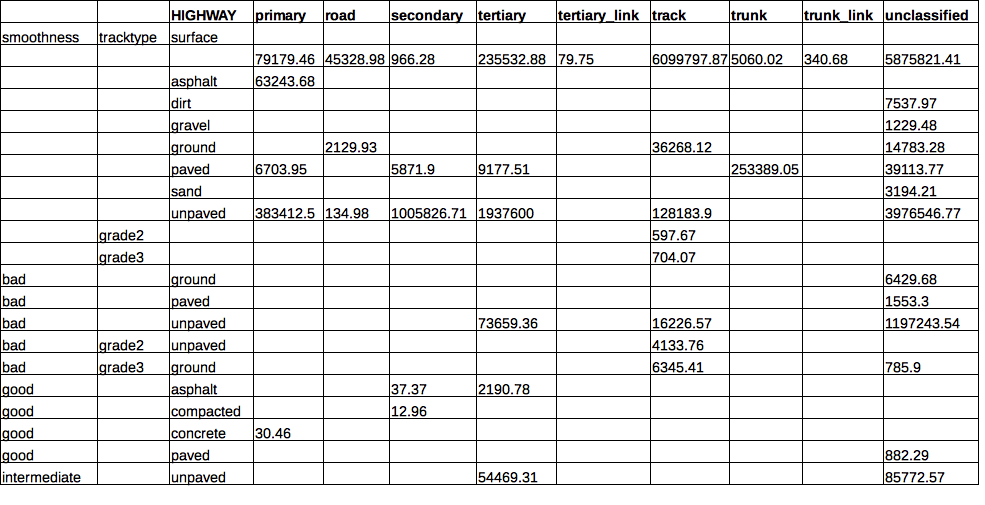
84 KB | Codrina | Results of GroupStats on the lengths of various categories of roads, with respect to type. | 1 |
| 02:55, 21 January 2019 | Fig11 OSMRoads RAI.png (file) |  |
75 KB | Codrina | Result of GroupStats on the OSM road network that has been tagged in good condition. | 1 |
| 02:51, 21 January 2019 | Fig10 excludedRoads.png (file) |  |
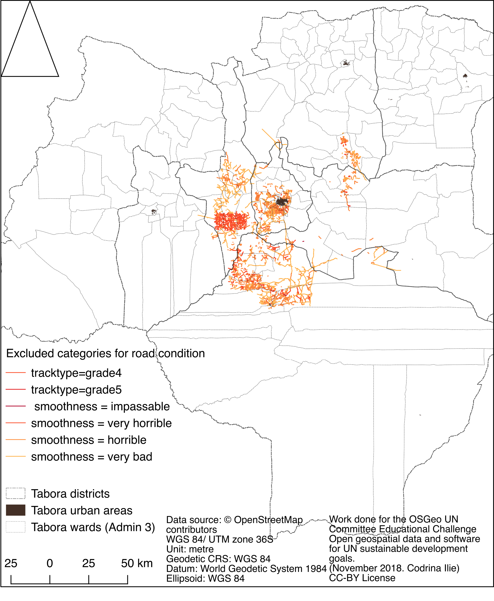
1.1 MB | Codrina | Spatial distribution of OSM roads that have been tagged as in bad condition. | 1 |
| 02:50, 21 January 2019 | Fig9 excludedRoadsbyCondition.png (file) |  |
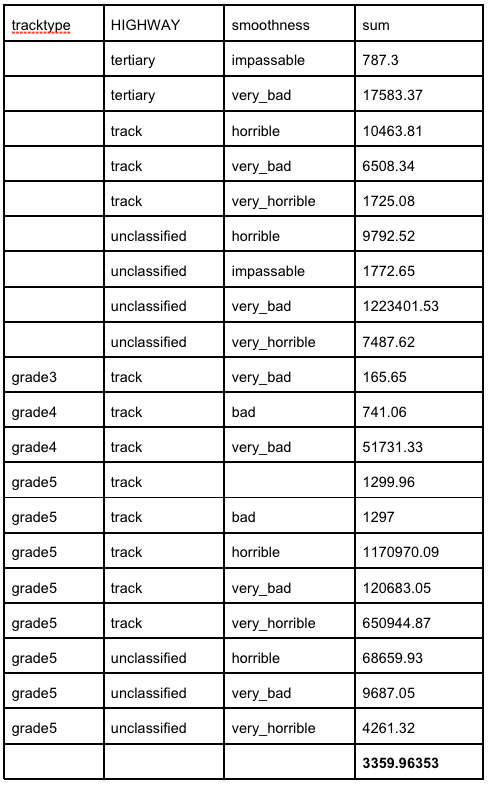
85 KB | Codrina | The results of running GroupStats to identify lengths of OSM roads tagged as in bad condition. | 1 |
| 02:47, 21 January 2019 | Fig8 mappingTags.png (file) |  |
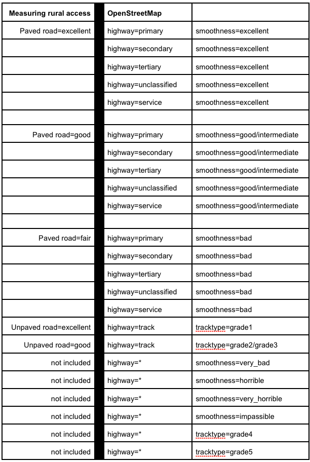
119 KB | Codrina | The correspondence between OSM tags and international standards for road condition. | 1 |
| 02:44, 21 January 2019 | Fig7 groupStats.png (file) |  |
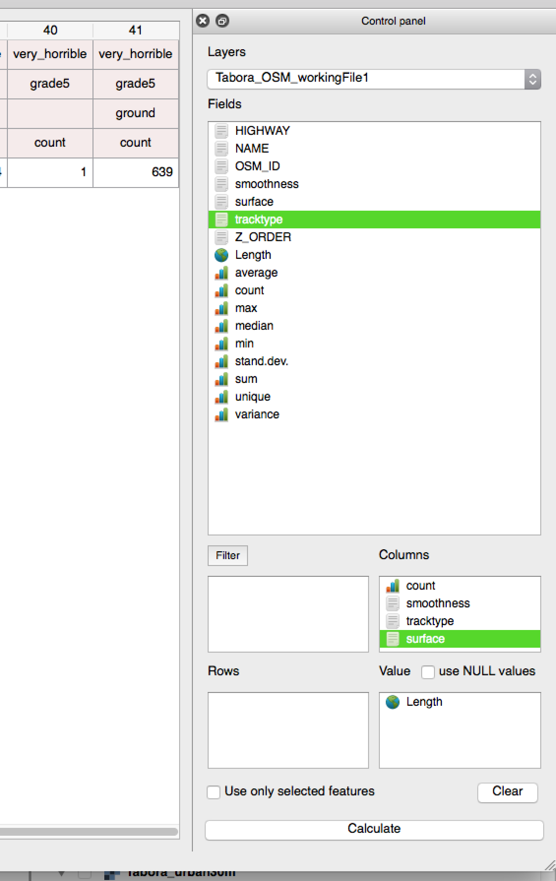
152 KB | Codrina | Example on how to use GroupStats | 1 |
| 02:41, 21 January 2019 | Fig6 roadCondition2.png (file) |  |
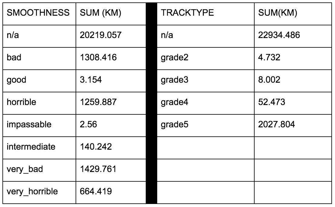
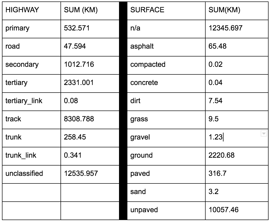
90 KB | Codrina | Results of GroupStats to identify the sum (in km) for each surface group of the highway features | 1 |
| 02:37, 21 January 2019 | Fig6 roadCondition1.png (file) |  |
118 KB | Codrina | Result of GroupStats to identify the sum (km) calculated for each surface group of the highway features. | 1 |
| 02:34, 21 January 2019 | Fig5 length.png (file) |  |
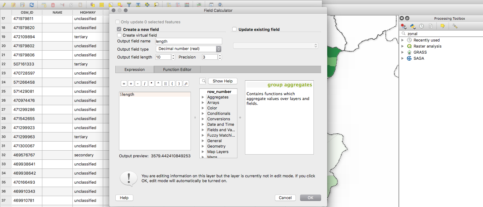
255 KB | Codrina | Example of working with the Filed Calculator to automatically calculate lengths of segments. | 1 |
| 02:31, 21 January 2019 | Fig4 zonalStats.png (file) |  |
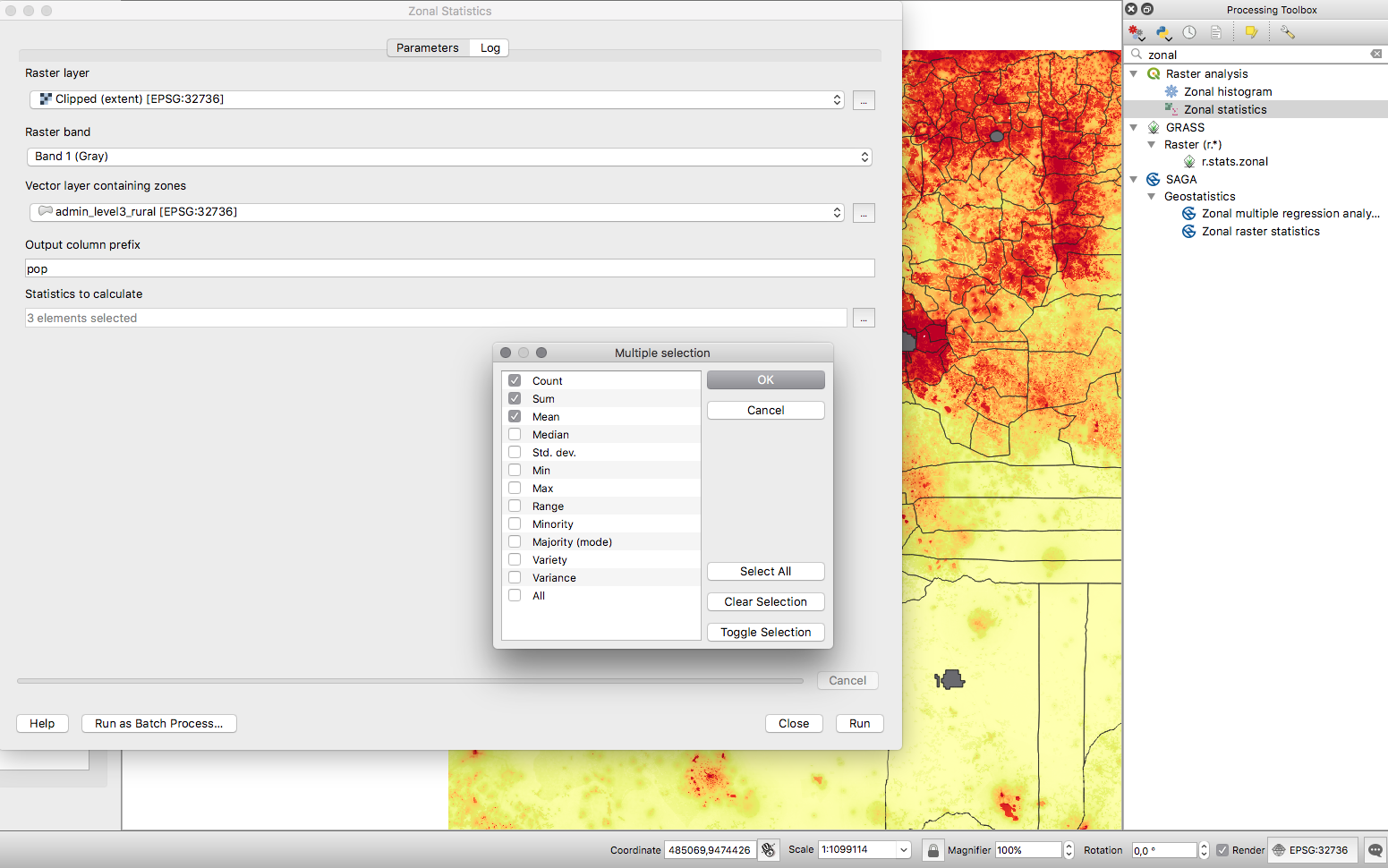
703 KB | Codrina | Zonal statistics functionality | 1 |
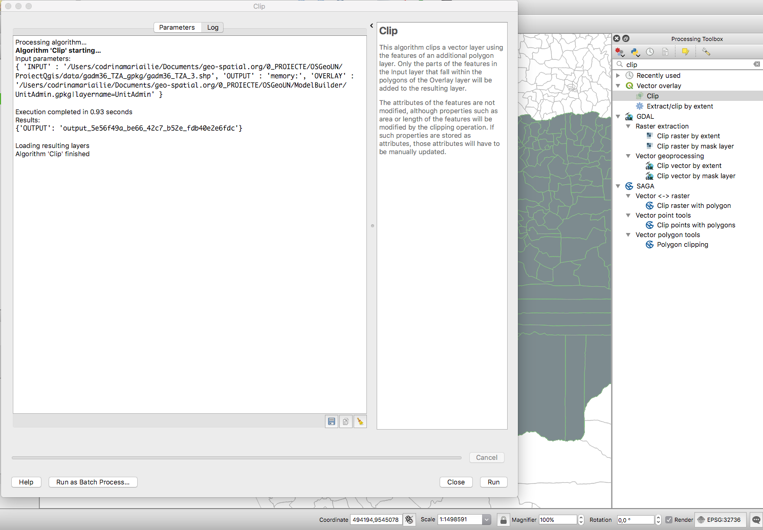
| 02:19, 21 January 2019 | Fig2 clip.png (file) |  |
303 KB | Codrina | Clip tool for vector data identified in the Processing Toolbox through search functionality. | 1 |
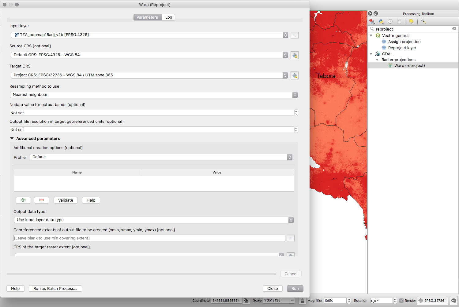
| 01:49, 21 January 2019 | Fig1 reproject.png (file) |  |
383 KB | Codrina | Screen capture of the reproject tool for a raster dataset, identified in the Processing toolbox using the search functionality. | 1 |
| 10:10, 17 January 2019 | Greenwood logo.png (file) |  |
22 KB | Wiki-Sdlime | 2 | |
| 13:11, 14 January 2019 | Osgeo-fr-logo.png (file) |  |
54 KB | Rhaubourg | new osgeo-fr logo | 1 |
| 10:41, 10 January 2019 | Safe-software-logo.png (file) |  |
4 KB | Wiki-Sdlime | 2 | |
| 10:25, 10 January 2019 | Crunchydata.png (file) |  |
47 KB | Wiki-Sdlime | 1 | |
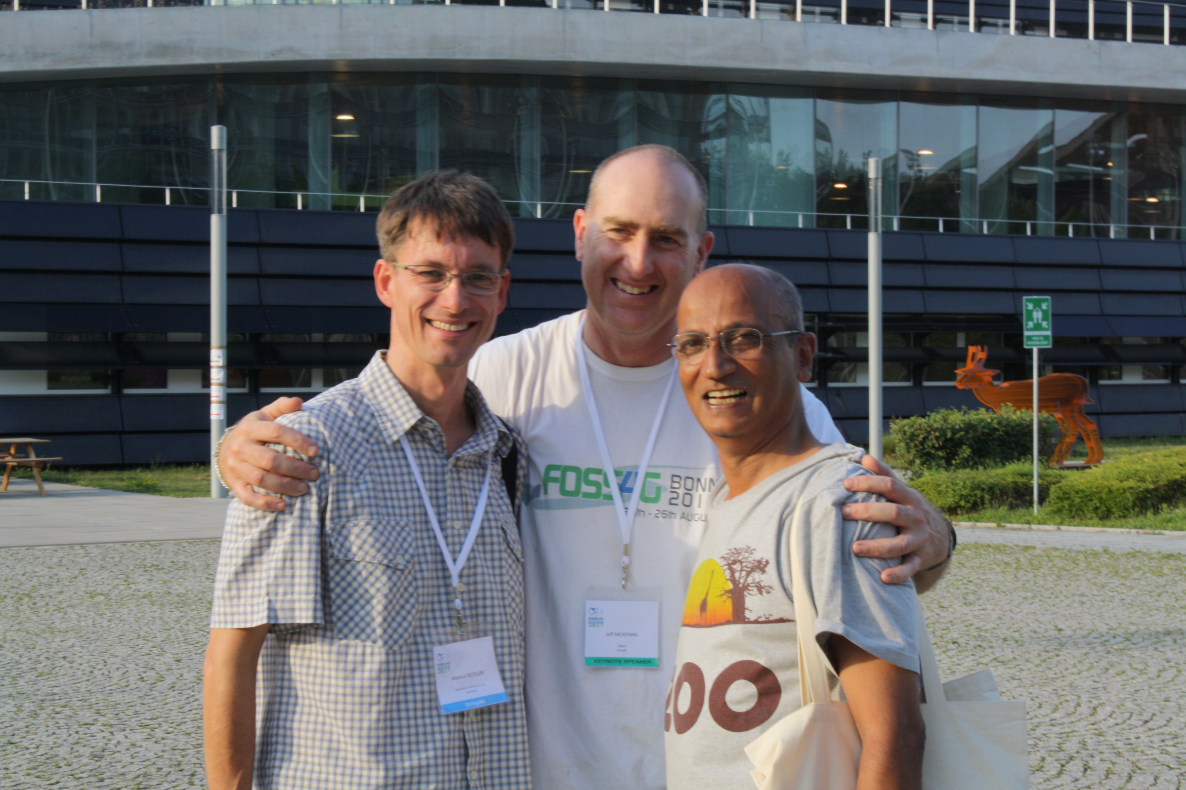
| 11:43, 8 January 2019 | Foss4g-founders.jpg (file) |  |
1.4 MB | Jmckenna | The 3 founders of the global FOSS4G event, (from left to right: Markus Neteler, Jeff McKenna, Venka Raghavan) who first met in Bangkok Thailand in 2004, and discussed creating an annual FOSS4G event, which would then go on to change the entire geo indu... | 1 |